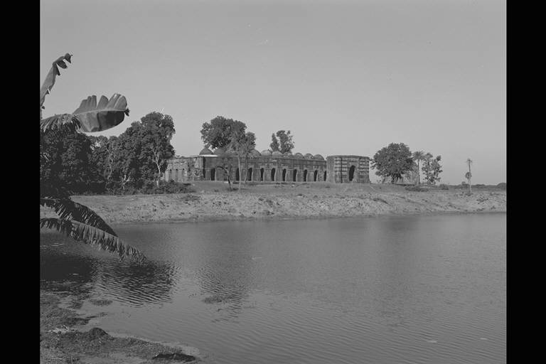
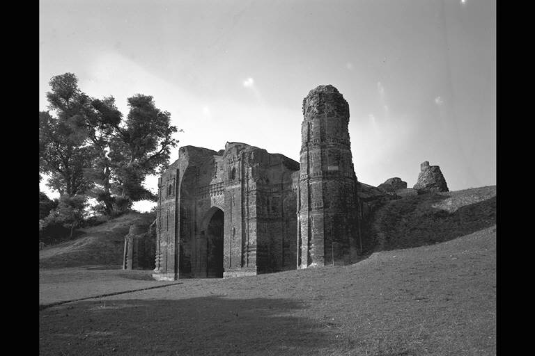
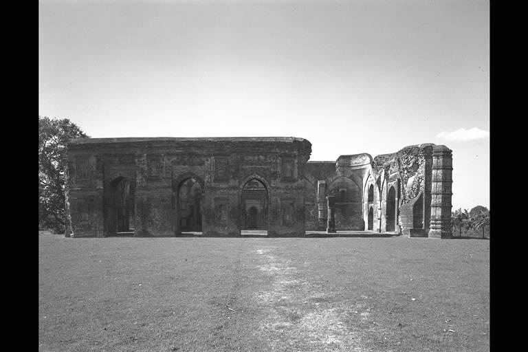
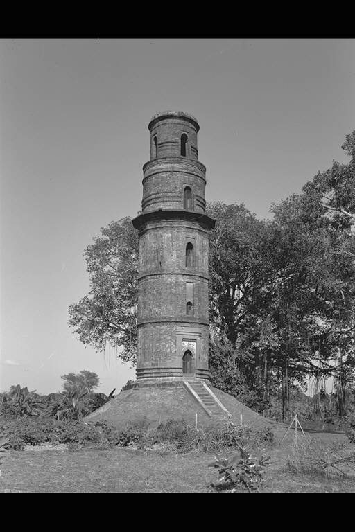
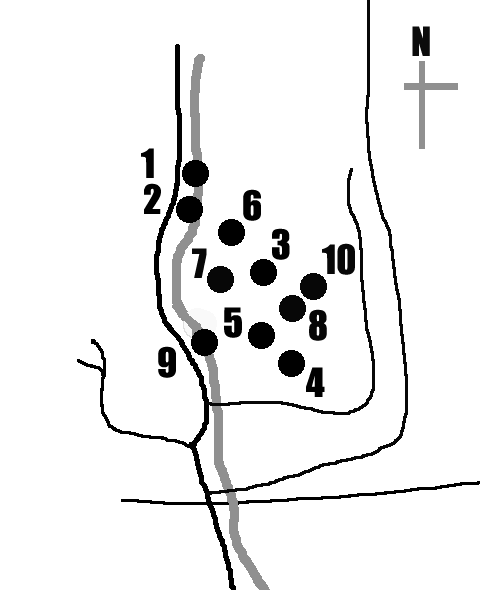
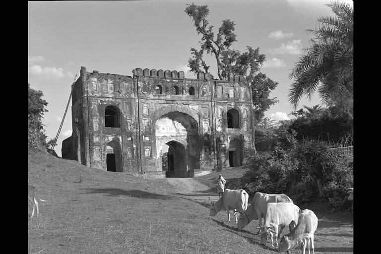
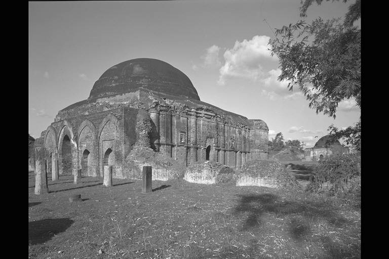
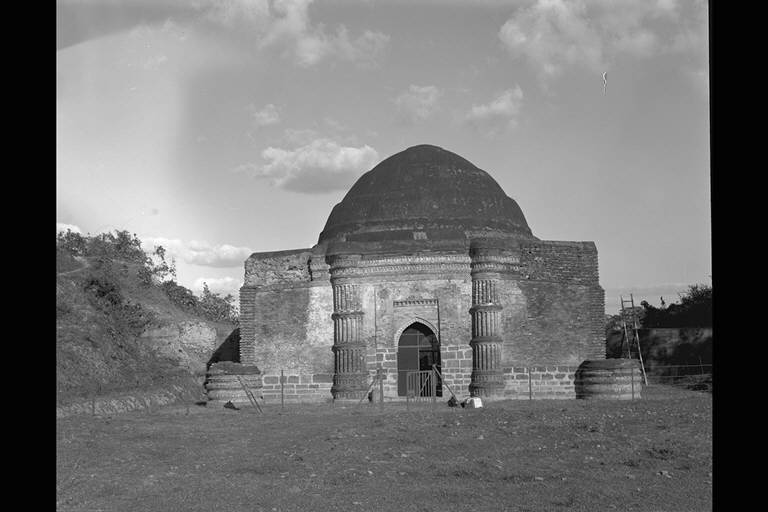
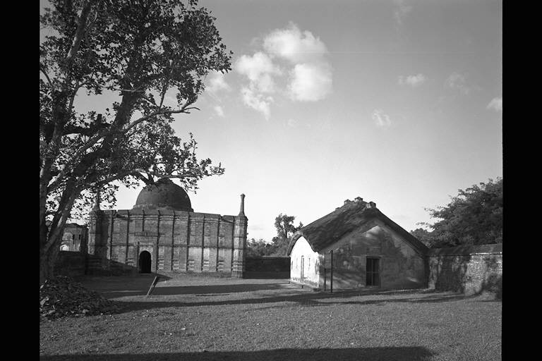
GAUR
A long time ago, this town was the capital of Hindu Kingdom called Lakhnauti. Around 1200, it was conquered by a Muslim named Bakhtiyar Khilji and fell under the Delhi Sultanate control. From that time, it had been controlled by sons of the sultans of Delhi until Fakhr ad-Din established a new independent Islamic kingdom in Bengal and moved the capital to Pandua in 1338. Around 1420, Gaur became the capital again called Jannatabad under the Ilyas Shah Dynasty and saw prosperity. This local dynasty of Bengal was conquered by Humayun of the Mughalid in 1537 and in the same year Sher Shah of the Sur Dynasty, that was struggling with the Mughal for supremacy, seized it. After the devastation by prevalence of the plague in 1575, it was incorporated into the Mughal Empire by the Great Emperor Akbar in 1576. In this area, many mosques built under the Ilyas Shah Dynasty between the late 15th century to the early 16th century remain. (Naoko Fukami)
![]() |
1.BARA SONA
MASJID
(1526) 2.DAKHIL DARWAZA (The first half of 16th C.) 3.CHAMKATTI MASJID (The last half ot 15th C. to The first half of 16th C. ) 4.LATTAN MASJID (1475?) 5.TANTIPARA MASJID (c.1480) 6.FIRUZ MINAR (1486?) 7.LUKOCHOLI DARWAZA (Middle of 16th C.) 8.CHIKA BUILDING (The last half ot 15th C. to The first half of 16th C. ) 9.GUMPTI DARWAZA (1512?) 10.QADAM RASUL (1513) |
![]() |
Having a common
name meaning "Big Golden Mosque" and situated a
few hundreds metres Northeast of Dakhil
Darwaza, this mosque is said to have been built as
Jama Masjid under the Sultan Nusrat Shah in 1526. The inside of this mosque consists of 11
spans in width and 4 spans in depth, though it had been
collapsed, leaving only the east corridor with arches and
vaulting. The east gate, which faces a
lake, still remains. (Matsuo Ara) →Plan and photos of each part |
▲View from the
southeast. The prayer room is seen behind the south, east and north gate. |
![]() |
As the name of this
meaning "entrance gate" suggests, this building
seems to have been a major gate to the Gaur castle. Some
scholars view it as having been built in the early 16th
century, judging from a gate to Bara Sona Masjid, which was a Jama
Masjid under Nusrat Shah's reign. Some insist that it was
built in 15th century; however, the year of the
foundation is hard to determine. The most of the facade
is made of reddish bricks and the original height was
nearly 20 metres. The central passage forms tunnel with
an arch shaped entrance, under which even elephants can
pass, extending for 35 metres. There is not so much
sculpture but the majestic dodecahedron five-tiered
towers at both ends are said to have crowned a small dome
on top. (Matsuo Ara) →Plan and photos of each part |
▲View from the southeast. |
![]() |
The name is said to
come from name of a peculiar Muslim group living in Malda
area. There is a theory that an inscription by Sultan
Yusuf Shah dated in 880AH (1475) belonged to this mosque.
The structure is similar to that of Lattan Masjid. It is assumed
that it was built between the late 15th century to the
early 16th century. (Matsuo Ara) →Plan and photos of each part |
▲Exterior viewed from the southeast |
![]() |
This mosque has
nearly the same square shape as Chamkatti Masjid in Gaur. Regarding
the name "Lattan", there are two theories, one
that it means a tumpler pigeon, and that it came from the
word dancer in the Bengali language, natin. However, it
seems more likely to have come from beautifully coloured
enameling bricks affixed to the outside walls. An
inscription marking the building date of 880AH (1475) has
been found nearby, though there is a theory that it
belongs to the aforementioned Chamkatti Masjid. In any
case, this mosque is assumed to have been built between
the late 15th century and the early 16th century. (Matsuo
Ara) →Plan and photos of each part |
▲Exterior viewed from the southeast |
![]() |
Inside this brick
mosque, all but the central pillars collapsed, but mihrab
on the qibla wall is well preserved. The meaning of the
common name is "House of weaver", however, this
mosque is said to have been built by a high official
under the reign of Yusuf Shah around 1480. It is known
for its rich decorative patterns covering the facade and
the west inside walls. (Matuo Ara) →Plan and photos of each part |
▲ Exterior viewed from the east |
![]() |
It is a tower of about 26 metre in height, situated outside the castle, on the southeast side of Dakhil Darwaza. The lower three tiers are polygon-shaped but the upper two tiers above the small roof are circular. There are various theories, such as it having originally been a minaret for a mosque, or a beacon, or it being a monument for victory, etc. Also, there is a theory that the top of the tower was flat, and that it was covered by a small dome. As an inscription bearing the name of King Saif al-Din was found, it is said that it was built either by S. Hamuzah Shah (1412) or S. Firuz Shah (1486), both of whom had the same title of King. However, the current name seems to have come from the latter. (Matsuo Ara) |
▲ Overall view of the south side |
![]() |
It is said this
mosque was called "Chika Masjid", since there
were numerous bats (chika) living in the building. It has
been thought that this was a mausoleum, mosque, or jail,
but as there is no remain of mihrab at the west side, it
is more believable that this with the other surrounding
buildings was buildings for an administrative body.
Judging from the vestiges of statues at the entrance and
the pillars, it can be seen as having been transformed
from a Hindu temple. Its plan, size, structure and style
are similar to Eklakhi Tomb in Pandua and it can be
assumed that it was built in the 15-16th century. (Matsuo
Ara) →Plan and photos of each part |
▲View from the southwest |
![]() |
Unlike Dakhil Darwaza and Kotwali Darwaza, it has a square plan and it is one of the east gates leading to the Gaur castle. Towers at both ends have only their basements, but the existing towers at the either sides of the central arch-shape entrance, with big domes on the roofs, make this comparatively small gate look imposing. Some scholars connect this building with an inscription marking a founding date of 1512. However, the connection has not been confirmed. Dr. C. Asher adopts a name "Gumti Darwaza". (Matsuo Ara) |
▲ View of the west side |
![]() |
This building is
known by a black marble stone considered as a
"footprint of the prophet" that used to be kept
in Pandua. Having a rectangular room surrounded by narrow
corridors on three sides, this building is assumed to
have been built in 1513 by Sultan Nusrat Shah, as
evidenced by an inscription remaining at the entrance.
The gate and the other buildings nearby are thought to
have been built in the Mughal period. Among these, a
building considered to be Fath Khan's tomb has a roof shaping
gentle arc, which came to be often seen in various part
of South Asia later on; it is a precious historical
heritage of the early Bengali architecture. (Matsuo Ara) →Plan and photos of each part |
▲Qadam Rasul (right) and tomb of Fath Khan (left) |